

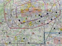
Refer to figure.
An aircraft is climbing straight ahead from an aerodrome EDST (N48°37.9' E009°25.8'). How would you determine the distance of the aircraft from the airport during the climb?
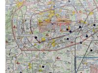
Refer to figure.
EDST Hahnweide does not have a DME and its only frequency is info, so you cannot receive radar vectors from ATC.
Calculating based on TAS & wind corrections is also a viable option. Since wind can vary significantly at different altitudes along the climb path, therefore, the pilot needs to use the TAS corresponding to an altitude ⅔ of the cruising altitude.
However, this only allows the groundspeed to be determined; it does not provide the distance, which must be calculated by multiplying the groundspeed by the time.
Estimating distance with climb rate and time
The following two formulae can be used to calculate the distance. For the climb, the average wind velocity is determined at an altitude ⅔ of the cruising altitude. This allows the average TAS and, after applying the wind correction, the average groundspeed to be determined. The average groundspeed is then multiplied by the time to determine the ground distance.
- Time (min) = Change in height (ft) / ROC (ft/min)
- Distance (NM) = Average Groundspeed (kt) x Time (hr)
Your Notes (not visible to others)
This question has appeared on the real examination, you can find the related countries below.
-
Austro Control1


 Use Keyboard Shortcuts
