

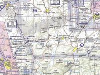
Refer to figure.
On which parallel of latitude is the DVOR/DME Salzburg located?
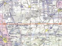
Refer to figure.
1. Firstly, locate the DVOR/DME Salzburg (SBG) looking for the appropriate symbol (an isosceles hexagon within a square).
2. Although the hemisphere is not shown, the chart depicts areas (Austria and Germany) of the northern hemisphere.
3. The DVOR/DME Salzburg (SBG) is along the 48°N parallel of latitude.
Your Notes (not visible to others)
This question has appeared on the real examination, you can find the related countries below.
-
Austro Control1


 Use Keyboard Shortcuts
Use your keyboard for faster navigation
